Bayouland radio amateurs
- Details
Mac Wade, director of the Port of Morgan City, was the August guest of the Bayouland Emergency Amateur Radio Service. He presented an in-depth assessment of the port's responsibilities and long-range goals. Of particular interest was an update on the new emergency center that is nearing completion and the role that communication will play in this new building. Another meeting with the BEARS and other interested citizens will be held at the port office so the members can view a power point presentation and view the various maps to become more aware of the role the port and the Atchafalaya play in everyday life in Morgan City.
Published by Daily Review 09/17/15
Published by Daily Review 09/17/15
Meetings focus on coastal projects
- Details
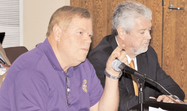
Port of Morgan City Executive Director Raymond “Mac” Wade speaks during the Louisiana Coastal
Protection and Restoration Authority Board meeting held Wednesday at the Morgan City Municipal
Auditorium. Wade requested that the port’s dredging projects be included in the state’s coastal
master plan citing the potential beneficial use of dredge material to restore the coast. At right
is Port of Morgan City dredging consultant Ansel Taylor.
BY ZACHARY FITZGERALD
Port of Morgan City leaders made their case Wednesday to include the dredging of the Atchafalaya River and surrounding waterways in the state’s coastal restoration master plan, saying that the fertile soil dredged out of the waterways could be used to rebuild coastal communities in dire need of material to create land. The Louisiana Coastal Protection and Restoration Authority Board held its regular monthly meeting Wednesday at the Morgan City Municipal Auditorium as part of its annual road show bringing meetings to different coastal Louisiana communities.
Port center to open in mid-October
- Details
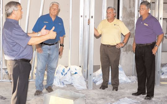
Architect Carl Blum, left, speaks to Morgan City Harbor and Terminal District commissioners
Joseph Cain, Scott Melancon and Gary Duhon during a tour of the Port of Morgan City’s Government
Emergency and Operations Center Monday. The center is scheduled to be substantially complete by
mid-October.
BY ZACHARY FITZGERALD
Some minor issues have pushed back the projected completion date of the Port of Morgan City’s $11 million Government Emergency and Operations Center by about two weeks to mid-October. Despite delays, work is nearly two-thirds finished on the center, which will house governmental tenants on a daily basis and serve as a command center during emergencies. It is located on La. 182 adjacent to the Morgan City Municipal Auditorium. A groundbreaking to begin construction of the center was held in December 2014. The 35,000-square-foot, Category 5 hurricane-resistant center is being paid for by $7.1 million in state capital outlay money and $3.9 million in Port of Morgan City funds.
Port gets visit from international trade vessel
- Details
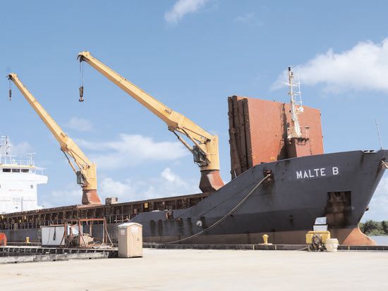
Malte B, a 300-foot ship based in Antigua and Barbados, arrived Wednesday at the Port of Morgan City to export 2,500 tons of rice to Haiti. The trip is the 19th that an import-export ship has made to the Port of Morgan City since August 2014.
For the 19th time in a year, an import-export ship made its way into the Port of Morgan City Wednesday afternoon, but port officials say ships could be making at least weekly trips to the port if adequate funds were available to dredge the waterways. A 300-foot-long ship named Malte B made its first voyage Wednesday to the Port of Morgan City. The Oslo Bulk 9, a 360-foot import-export ship, had made previous visits to the port. The Malte B is based in Antigua and Barbados with a Russian and Filipino crew, Port of Morgan City Executive Director Raymond “Mac” Wade said. The ship is exporting 2,500 tons of rice for Planters Rice Mill of Abbeville to Haiti, Wade said. Rice trucks began arriving July 31 at the Port of Morgan City in preparation of the ship’s arrival. About 150 truckloads of rice made it to the port, he said. Wade expected the ship to leave the port sometime today. The last time an import-export ship came to Morgan City was in early May when the Oslo Bulk 9 shipped 3,500 tons of rice to Haiti.
New Operations & Emergency Center
- Details
Channel 3 KATC news report on new operations center.
Stations will provide real-time weather, water data
- Details
 Darren Wright, physical oceanographic real-time system program
manager for the National Oceanic and Atmospheric Administration,
speaks Monday about the two new stations recently installed
in the Atchafalaya River Bar Channel.
Published by Daily Review May 12, 2015